Recap GRASS GIS Community Sprint at FOSS4G 2016
Recap: GRASS GIS Community Sprint at FOSS4G 2016
Thoughts and impressions from the GRASS GIS Community Sprint at FOSS4G 2016, Bonn
Last week we had the pleasure to attend the International FOSS4G 2016 Conference in Bonn. But not only that... before and after the conference, two "Code Sprints" took place.
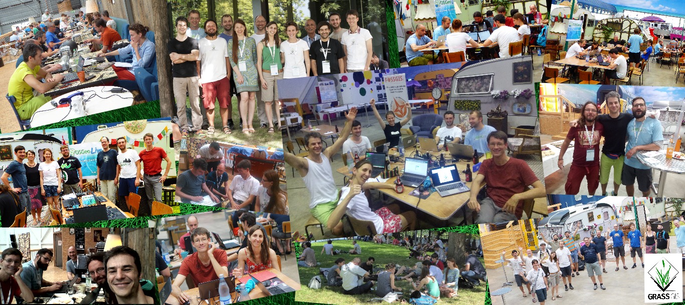
What is a "Code Sprint"? Basically, it is a group of free and open source developers who (fueled with beer, coffee and snacks/pizza/sandwiches) gather to develop new stuff, enhance existing tools, perform bug fixing, translate and write documentation, discuss and decide the way to go with the software they contribute to (essentially the software they love we would say, it all comes to that). Anyway, in this context, also GRASS GIS developers gathered in what we usually call the "Community Sprints", since it’s not only a meeting of developers but also of users, and other contributors - everybody is welcome and their help appreciated.
So, what did we do at these two sprints?
Well, first of all, we had a great time! It is always a great joy to meet again (or in some cases even for the first time) with those people that use to answer your emails in the mailing list(s), fix or enhance modules, help in so many ways... One feels at home :-)
But we also worked a lot! The most important is that the last GRASS GIS 6 version was released on Sunday at 1:00 am or so [1]. Also several other issues were discussed and addressed, i.e.: the next minor release of 7.0.5 - planned for mid of September, and the new major release of GRASS GIS 7.2.0, which is planned for 1st of October 2016. Furthermore, the styling of a new Web site for the GRASS GIS project was lively discussed. Moreover, the participants fixed a number of bugs, backported numerous features, cleaned outdated tickets, and added some new features. Even a new add-on was developed in these days. Eventually also some tutorials explaining how to work with time series and Sentinel-2 satellite data got written up. Last but not least, a member of the community provided a new flyer for GRASS GIS. Please help us translating, improving and distributing it!
Oh! And by Sunday evening, also the PSC election 2016 time was over, and
we got a new PSC (See results
here)!
Congratulations!!! For the first time, users that have contributed to
GRASS GIS project were formally invited to vote... Isn't that great?
Therefore, Community Sprints, Community Spirit ;-)
Join and enjoy GRASS GIS!
For details, see also our related Wiki page
About GRASS GIS
The Geographic Resources Analysis Support System (http://grass.osgeo.org/), commonly referred to as GRASS GIS, is an Open Source Geographic Information System providing powerful raster, vector and geospatial processing capabilities in a single integrated software suite. GRASS GIS includes tools for spatial modeling, visualization of raster and vector data, management and analysis of geospatial data, and the processing of satellite and aerial imagery. It also provides the capability to produce sophisticated presentation graphics and hardcopy maps. GRASS GIS has been translated into about twenty languages and supports a huge array of data formats. It can be used either as a stand-alone application or as backend for other software packages such as QGIS and R geostatistics. It is distributed freely under the terms of the GNU General Public License (GPL). GRASS GIS is a founding member of the Open Source Geospatial Foundation (OSGeo).
The GRASS Development Team, September 2016