NAME
d.barscale - Displays a barscale on the graphics monitor.KEYWORDS
display, cartographySYNOPSIS
d.barscale
d.barscale --helpd.barscale [-ftn] [style=string] [at=x,y] [length=integer] [units=string] [label=string] [segment=integer] [color=name] [bgcolor=name] [text_position=string] [width_scale=float] [font=string] [fontsize=float] [path=name] [charset=string] [--help] [--verbose] [--quiet] [--ui]
Flags:
- -f
- Use feet/miles instead of meters
- -t
- Draw the scale bar without text
- -n
- Display north-arrow symbol.
- --help
- Print usage summary
- --verbose
- Verbose module output
- --quiet
- Quiet module output
- --ui
- Force launching GUI dialog
Parameters:
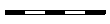
- style=string
- Type of barscale to draw
- Options: classic, line, solid, hollow, full_checker, part_checker, mixed_checker, tail_checker, up_ticks, down_ticks, both_ticks, arrow_ends
- Default: classic
 classic: Classic style
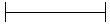 line: Line style
 solid: Solid style
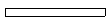 hollow: Hollow style
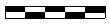 full_checker: Full checker style
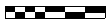 part_checker: Part checker style
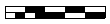 mixed_checker: Mixed checker style
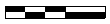 tail_checker: Tail checker style
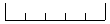 up_ticks: Up ticks style
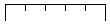 down_ticks: Down ticks style
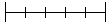 both_ticks: Both ticks style
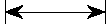 arrow_ends: Arrow ends style
- at=x,y
- Screen coordinates of the rectangle's top-left corner
- (0,0) is lower-left of the display frame
- Options: 0-100
- Default: 0.0,10.0
- length=integer
- Length of barscale in map units
- Options: 0-
- Default: 0
- units=string
- Barscale units to display
- Options: meters, kilometers, feet, miles
- label=string
- Custom label of unit
- segment=integer
- Number of segments
- Options: 1-100
- Default: 10
- color=name
- Bar scale and text color
- Either a standard color name or R:G:B triplet
- Default: black
- bgcolor=name
- Background color (drawn behind the bar)
- Either a standard color name, R:G:B triplet, or "none"
- Default: white
- text_position=string
- Text position
- Options: under, over, left, right
- Default: right
- width_scale=float
- Scale factor to change bar width
- Options: 0.5-100
- Default: 1
- font=string
- Font name
- fontsize=float
- Font size
- Options: 1-360
- Default: 12
- path=name
- Path to font file
- charset=string
- Text encoding (only applicable to TrueType fonts)
Table of contents
DESCRIPTION
d.barscale displays a barscale on the graphics monitor at the given screen coordinates. If no coordinates are given it will draw the barscale in the bottom left of the display.The barscale can drawn in a number of styles (see style parameter for their previews).
NOTE
d.barscale will not work in Lat/Lon locations as the horizontal scale distance changes with latitude. Try d.grid instead.SEE ALSO
d.graph, d.grid, d.legend, d.northarrow, g.regionAUTHORS
Unknown, from USACE/CERL.Major rewrite for GRASS 7 by Hamish Bowman
SOURCE CODE
Available at: d.barscale source code (history)
Latest change: Thu Feb 3 11:10:06 2022 in commit: 73413160a81ed43e7a5ca0dc16f0b56e450e9fef
Main index | Display index | Topics index | Keywords index | Graphical index | Full index
© 2003-2022 GRASS Development Team, GRASS GIS 8.0.3dev Reference Manual